St Neots
185 PlacesAbout St Neots
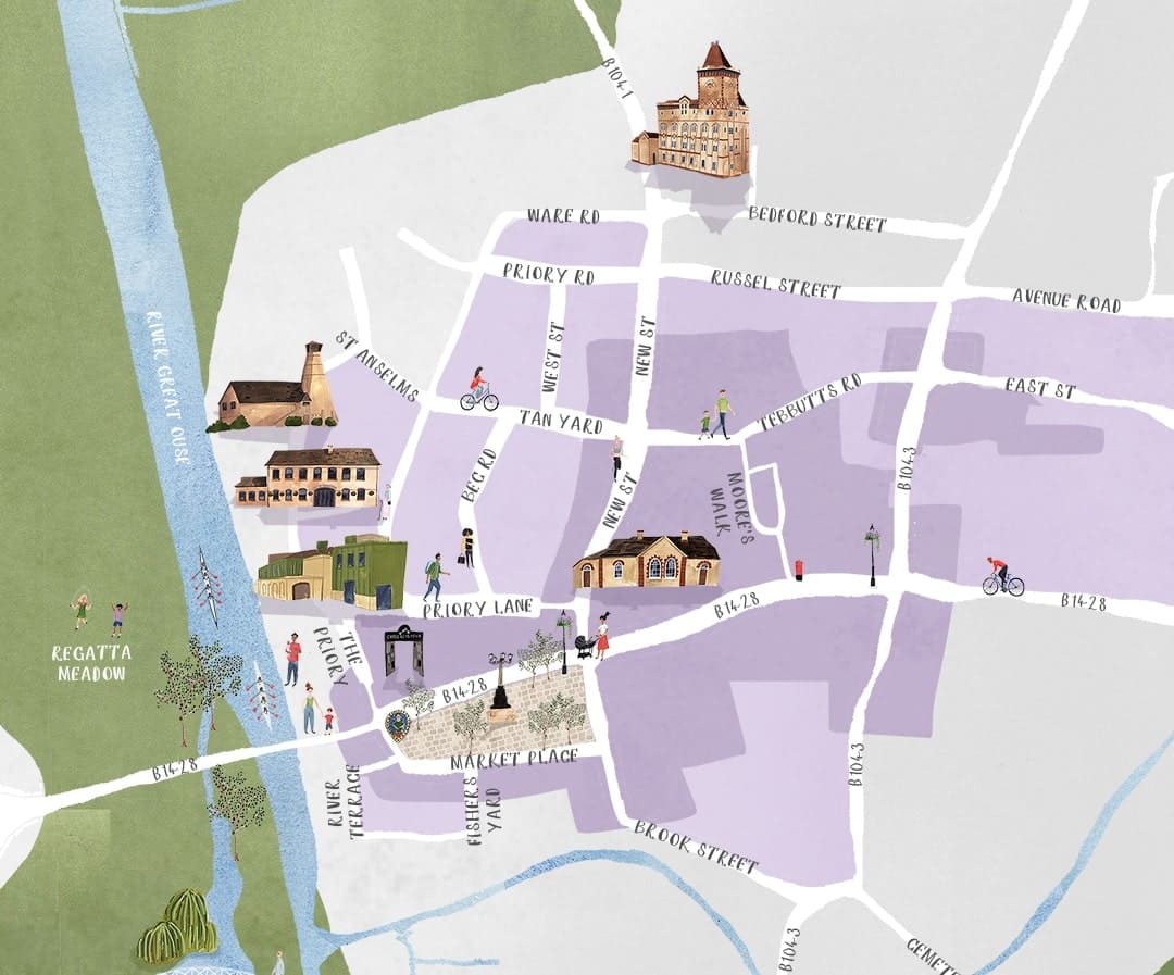
Cambridgeshire's largest town, situated on the banks of the River Great Ouse.
St Neots is one of the four historic market towns of Huntingdonshire, each with its own unique character and attractions. Use our interactive map to discover local businesses, historical sites, and hidden gems throughout the town.
Explore St Neots on our Interactive Map
Discover all 185 places with our detailed, interactive map
Interactive Map Features
Our interactive map is designed to help you explore St Neots with ease. Here's what you can do:
Categories
Filter places by category to find exactly what you're looking for - from restaurants and shops to attractions and services.
Search
Quickly find specific places with our search feature. Search by name or use tags to discover places matching your interests.
Embedded Artwork
Discover beautiful digital artwork embedded throughout the map, showcasing local landmarks and scenes from St Neots. Zoom in to see more detailed artwork.
Distance Calculation
See how far places are from your current location, with distances shown in meters/kilometers or walking time.
Explore St Neots on Foot
Self-Guided Walking Tours
Discover St Neots at your own pace with our self-guided walking tours. Our interactive map helps you navigate between historical landmarks, local businesses, and points of interest.
Each place on the map includes detailed information about its history, services, and unique features. Use the distance calculator to plan your route and see how far you'll be walking.
Explore St Neots by Category
St Neots offers a variety of places to visit across different categories. Click on a category to explore it on the map.
Featured Places in St Neots
Here are some of the most popular places to visit in St Neots. Explore the map to discover more!